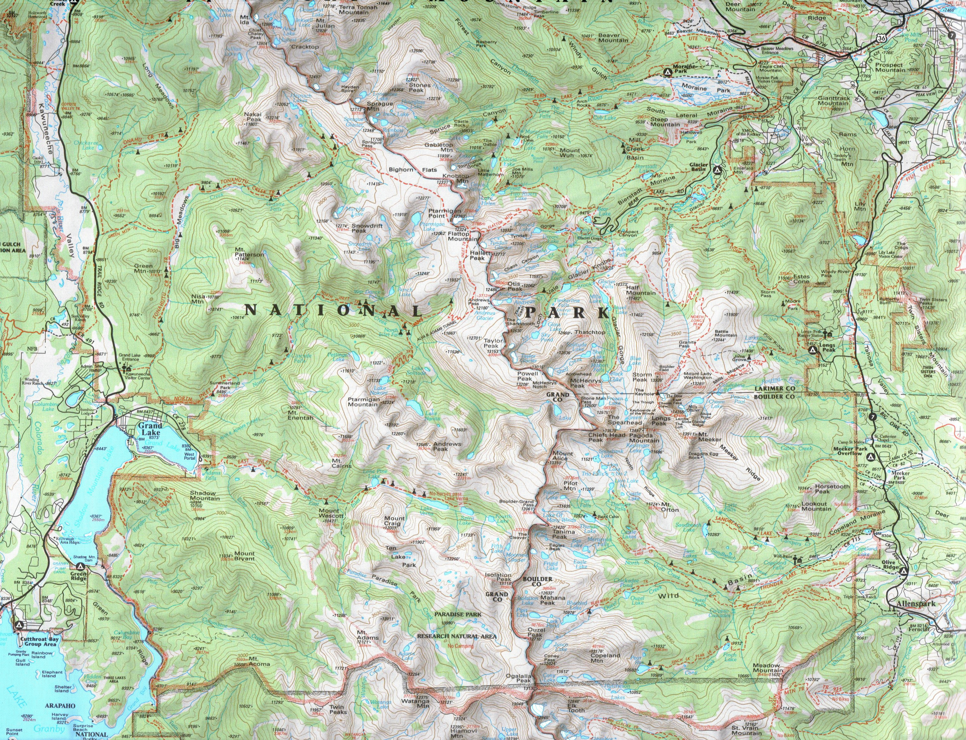
| Estes Cone Hike 06/18/2013 |
| This hike starts at the Long Peak Ranger Station in Rocky Mountain NP. It goes to an elevation of 11,006 feet for a vertical climb of 1538 feet and a distance of 6.67 miles. |
| The trailhead of the 6.8 mile hike. |
| Remains of gold mine at the half way point. |
| Trail in Bristlecone Pine area. |
| View from the summit to the west. |
| Rangers working on trail. |
| The destination, Estes Cone Peak. |
| Meeker Mountain on the left and Longs Peak on the right. |
| Estes Cone has many Bristlecone Pine trees. |
| Panoramic from the summit to the west. |
| View of Estes Cone from the trailhead. |


| Approaching the summit. |


| The only stream to cross is by the gold mine. |

| At the summit looking toward RMNP. |


| Tailings from the gold mine next to the creek. |
| The last stretch was very serious climbing. |