| Rollins Pass Hike 8/5/08 |
| Rollins Pass is located 14 miles up a mountain road north from Winter park. This hike was a 6.6 mile roundtrip hike with a vertical change of only 240 feet. The trail was High Lonesome Trail which is part of the Continental Divide Trail. |
| Corona Lake west of the trailhead parking lot. |
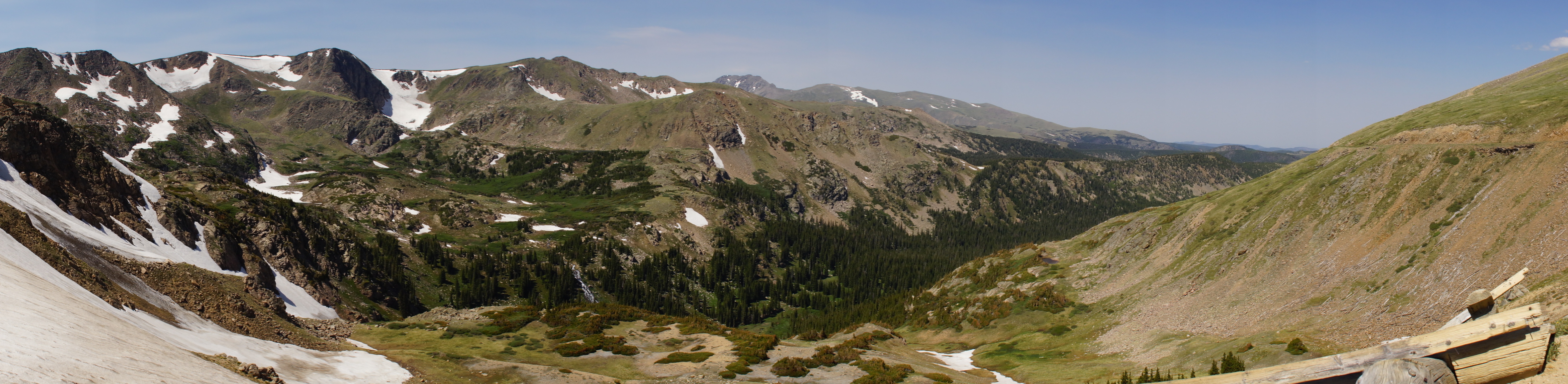
| The first valley-- the photo taken from Rollins Pass trailhead. |
| Devils Thumb Lake in the third valley from the Vista. |
| Third and last valley along the trail. We decide to hike to the Vista above Devils Thumb Lake. |
| An abandoned railroad trestle near Rollins Pass. |


| View from the Rollins Pass trailhead parking lot looking east. |
| View looking back at the trestle from the trailhead. |
| One of the snowfields we had to cross. |

| Rollins Pass where the High Lonesome Trail begins. |

| The massive wildflower field of American Bistort at the trailhead of High Lonesome Trail. |

| An adventerous hiker with a goal of hiking the entire CDT. |


| An adventerous hiker with a goal of hiking the entire CDT. It was a lady in a dress |


| We start back. |


| We continue on the CDT until the trail splits and we take the Devils Thumb Lake Trail. |
| King Lake with the railroad trestles of Rollins Pass Road. Photo taken on another hike. |

| The trail to the Vista was bordered by wildflowers. |

| Bob & Betty Lake trail passes King Lake and goes into the 2nd valley. |
| King Lake. This also has trails into the 2nd valley-Bob & Betty lakes. |